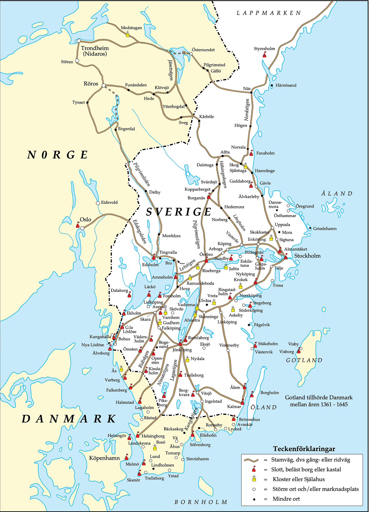
This map I found today is interesting. It is a newly made map based on old sources to depict the road network, as well as cities and trading places as it looked in the middle of the 16th century. As you can see, the road network was very underdeveloped, it was a matter of widened paths through vast areas of wilderness.
The largest city was Stockholm but …
Keep reading with a 7-day free trial
Subscribe to Nordic Chronicle to keep reading this post and get 7 days of free access to the full post archives.


